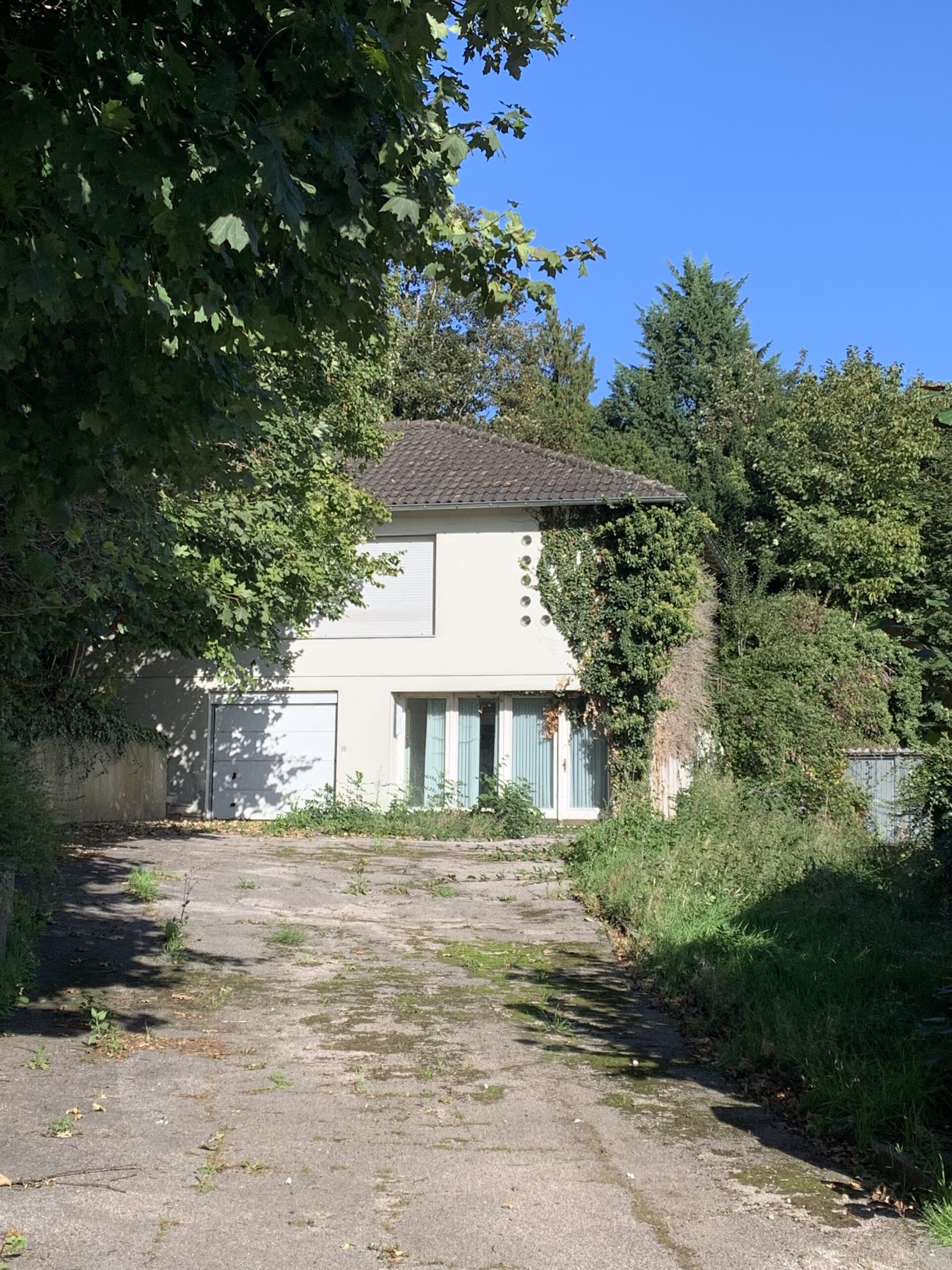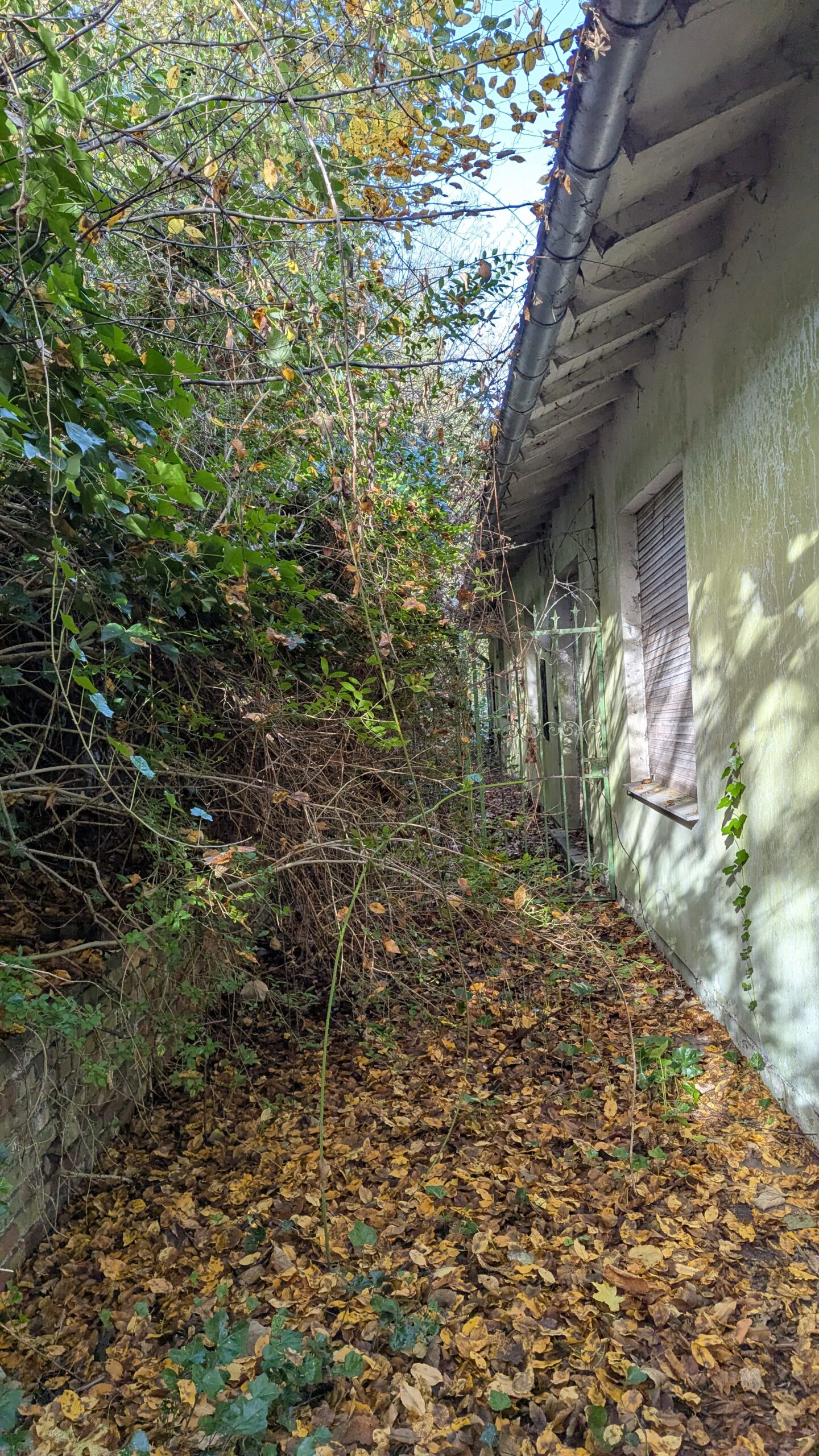
The wall speaks
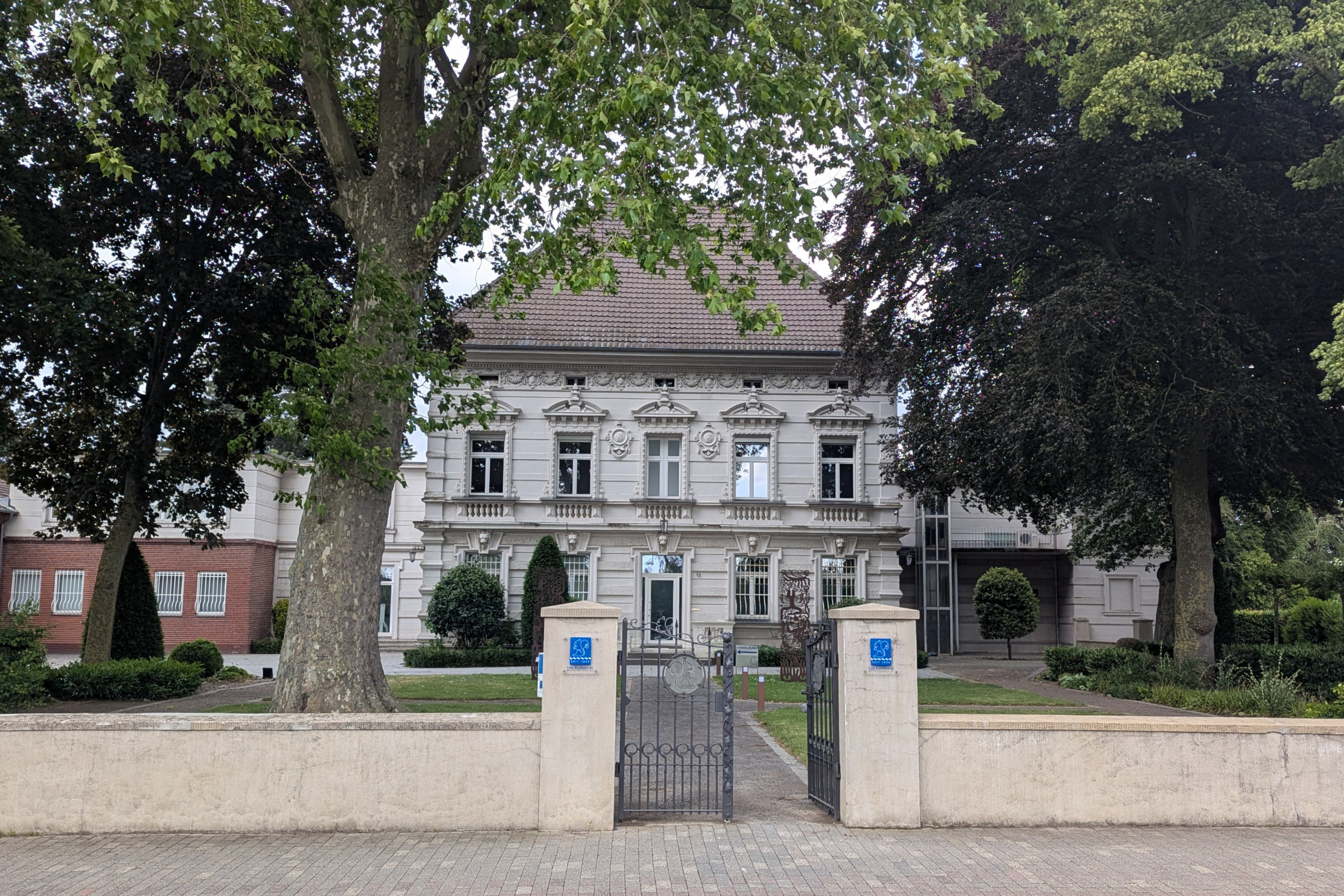
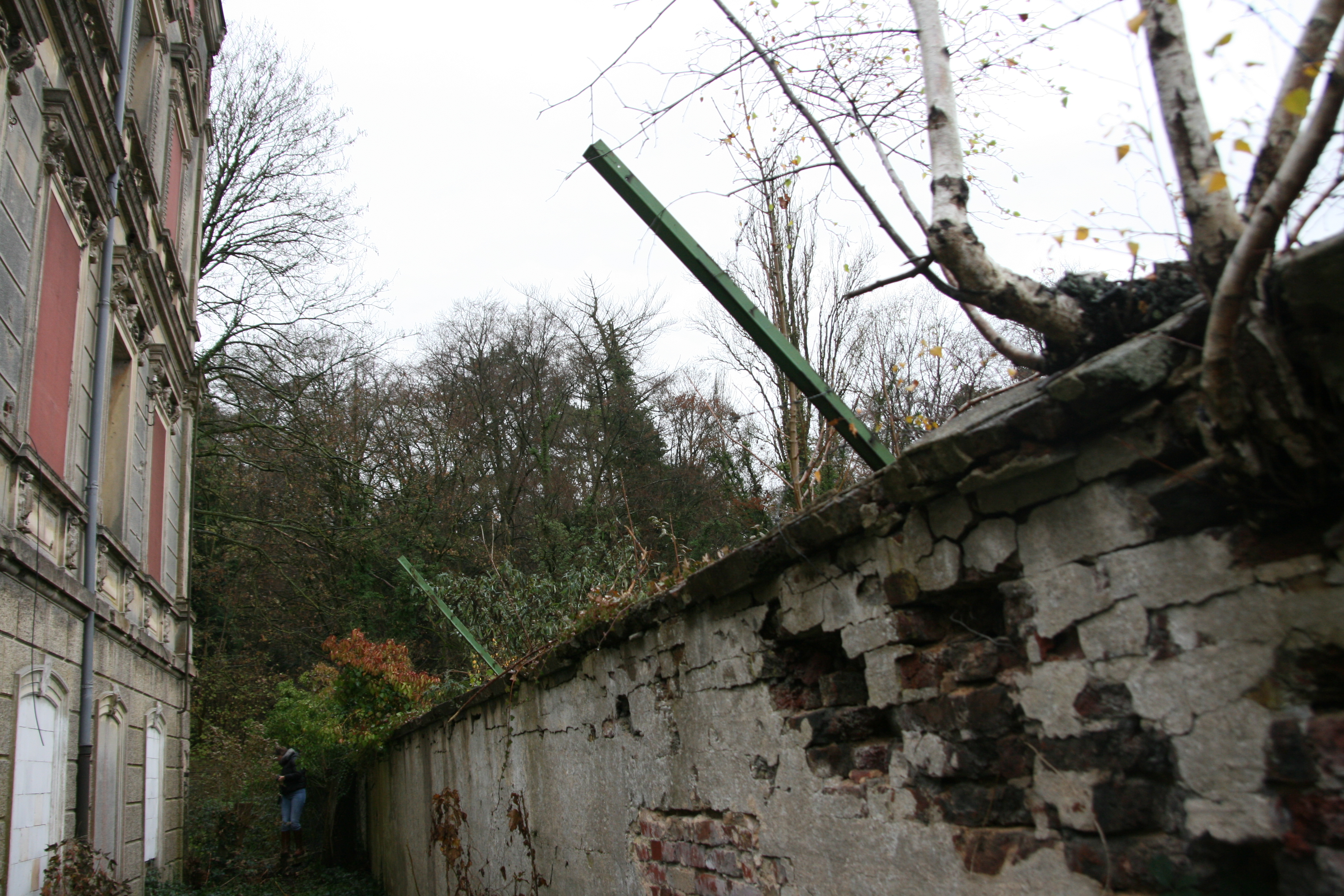
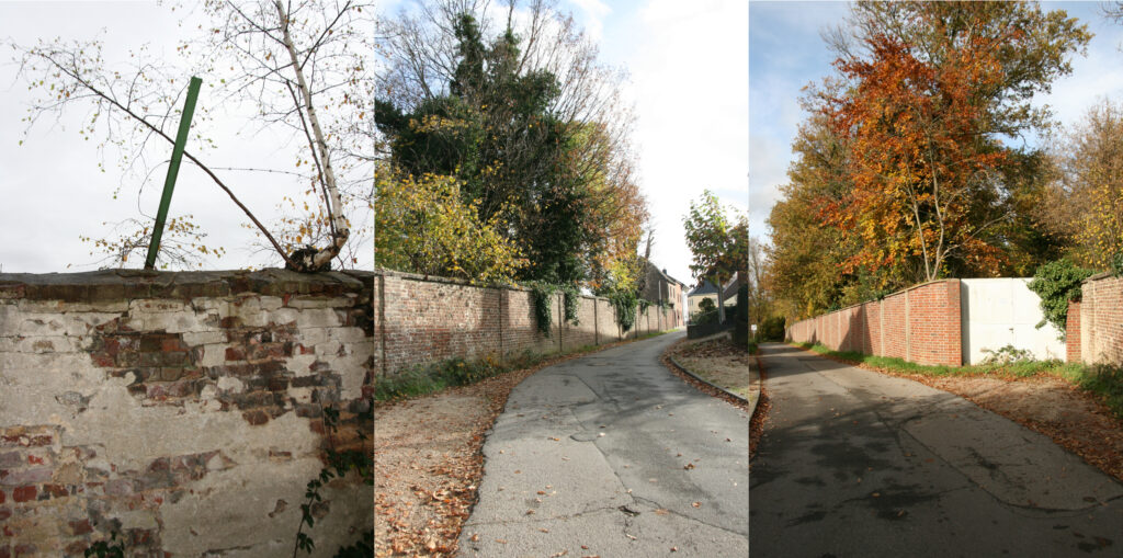
When you visit Villa Buth, the brick wall is always in view. It completely surrounds the grounds, encompassing both the garden and the park. As you walk around the grounds, you realise:One wall does not equal the other.The structure changes along the boundary of the plot.
The wall speaks explores the demarcation of construction phases, the definition of construction periods and the search for traces along the Wall. The border fortifications are mapped out: What does the Wall tell us when we take a closer look at it?
A walk along the Wall
The interactive map takes you on a tour around the perimeter of Villa Buth and its grounds. It offers an initial insight into the historythat the wall tells us. If you click on the points in the order shown, this most closely resembles a walk around the site, during which you gradually walk along and examine the wall.
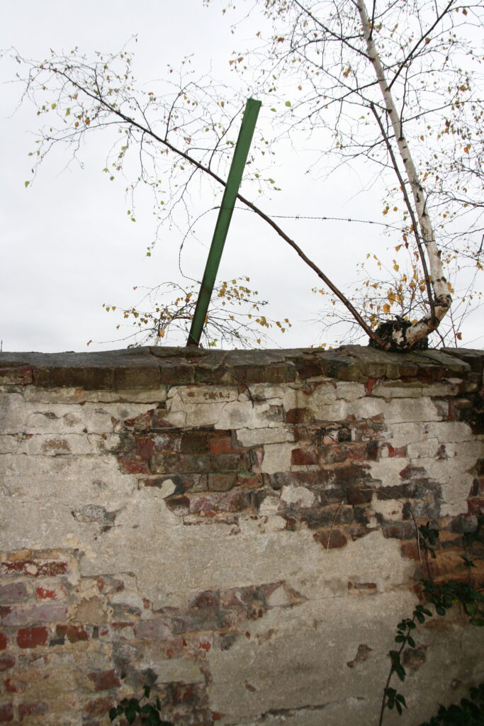
The sections of the Wall
Section boundaries
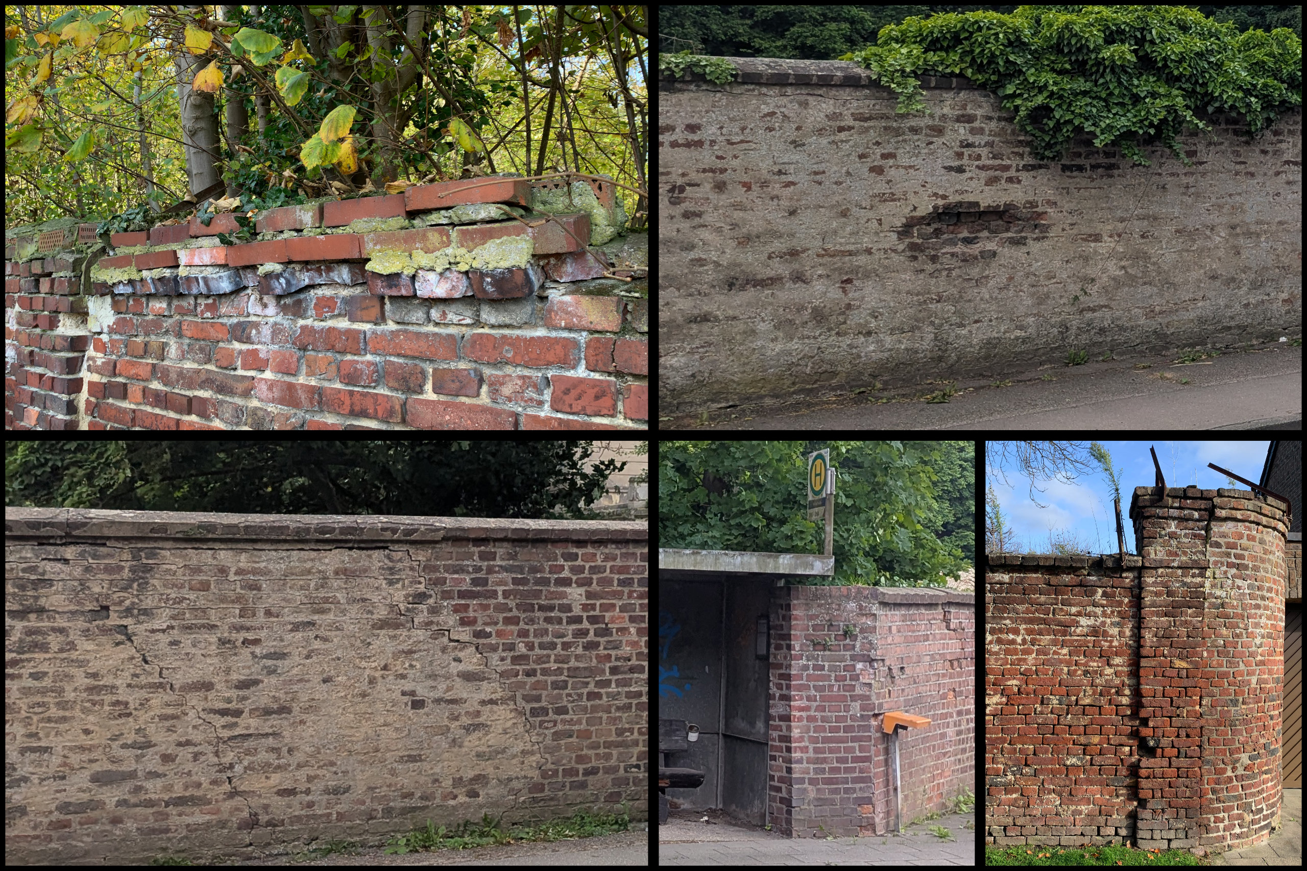
The brick wall can be divided into three major construction phases, disregarding minor structural alterations. This division is based on detailed observations made during an architectural walk.
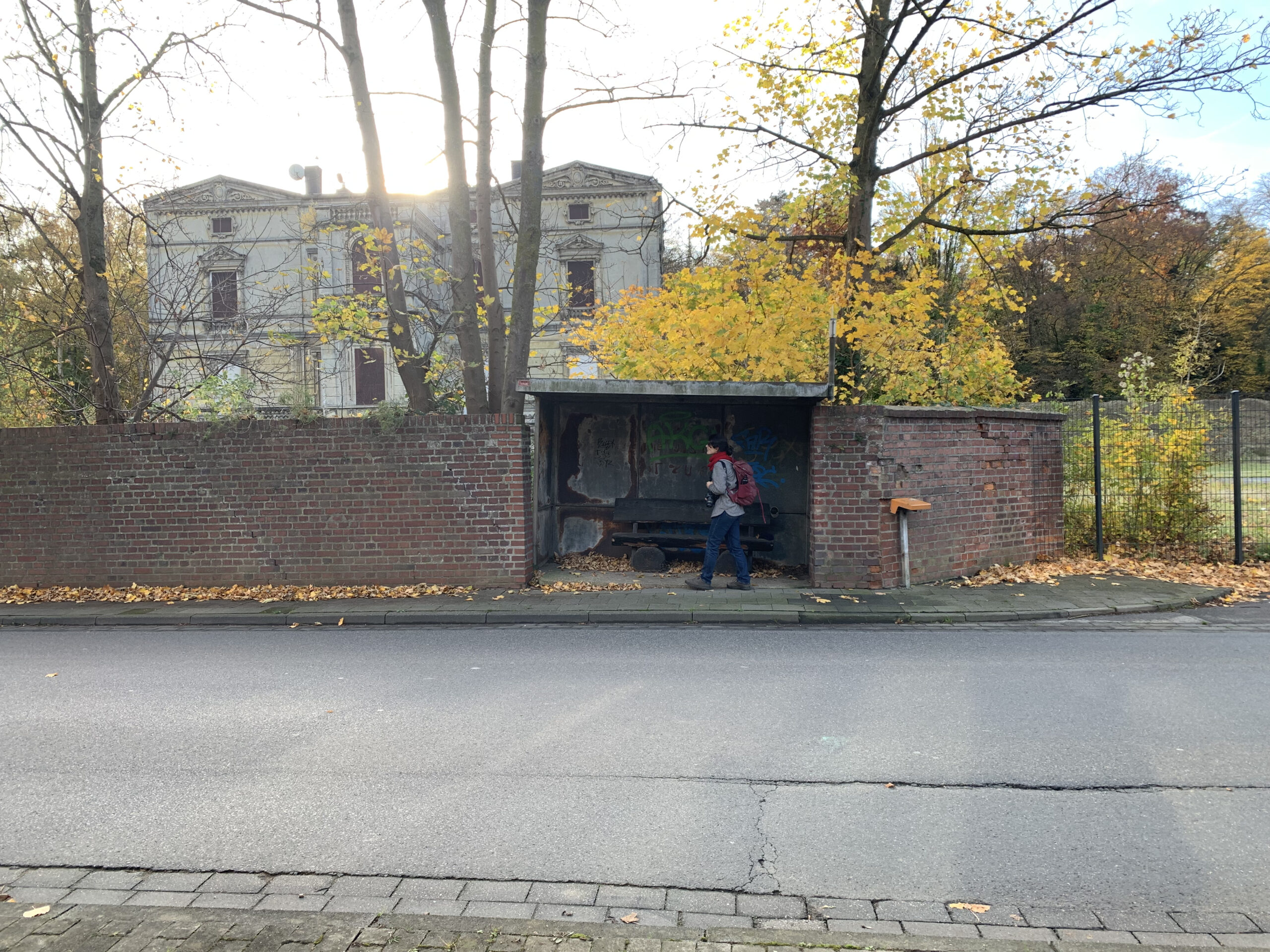
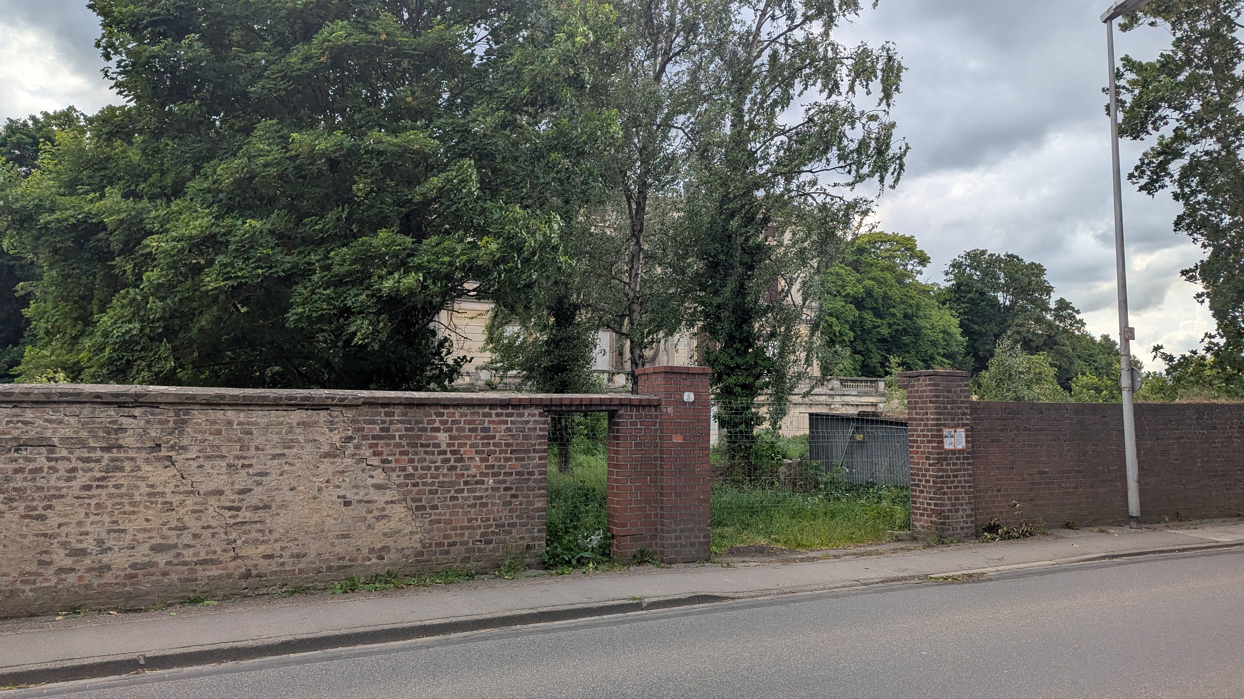
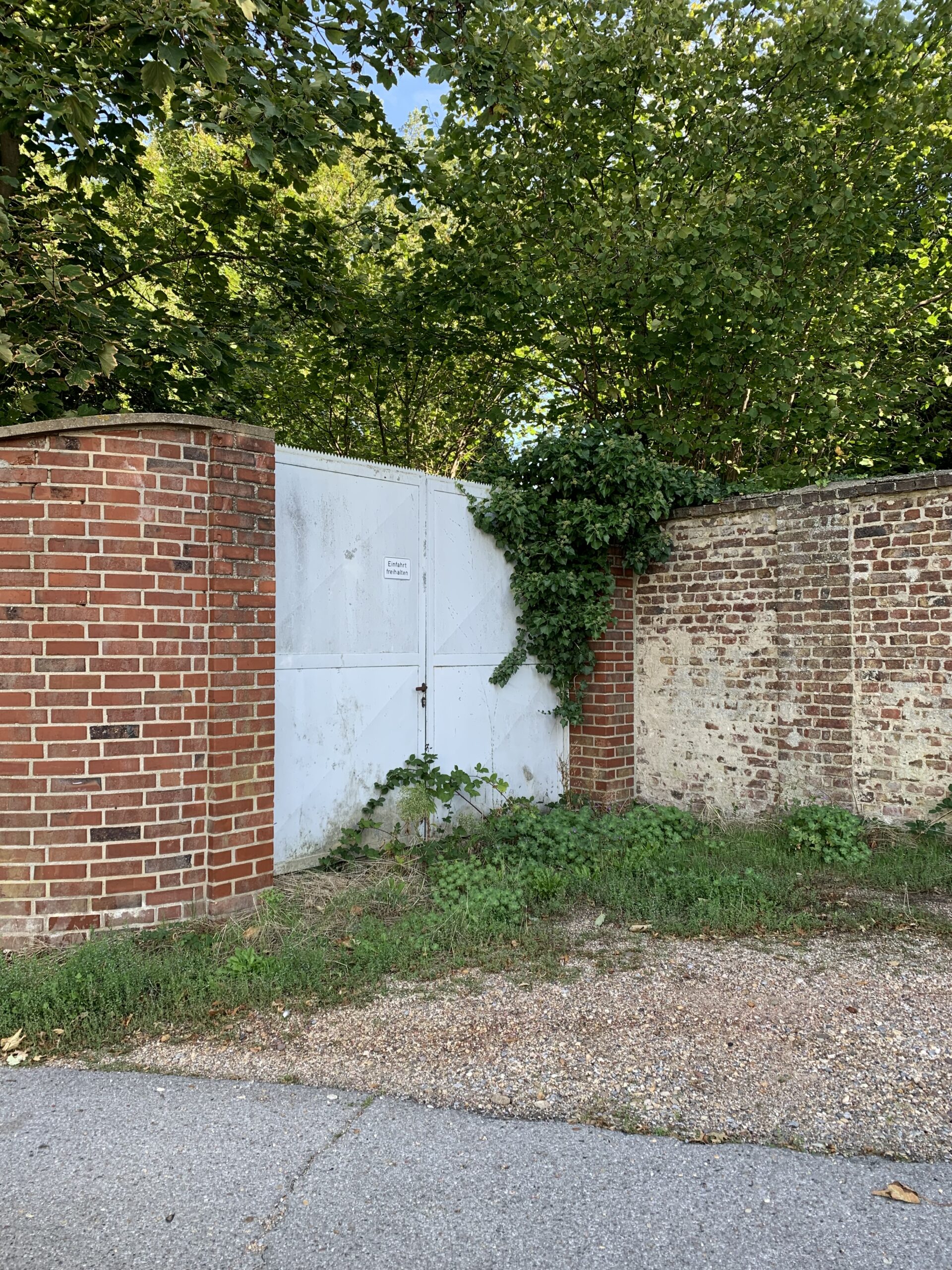
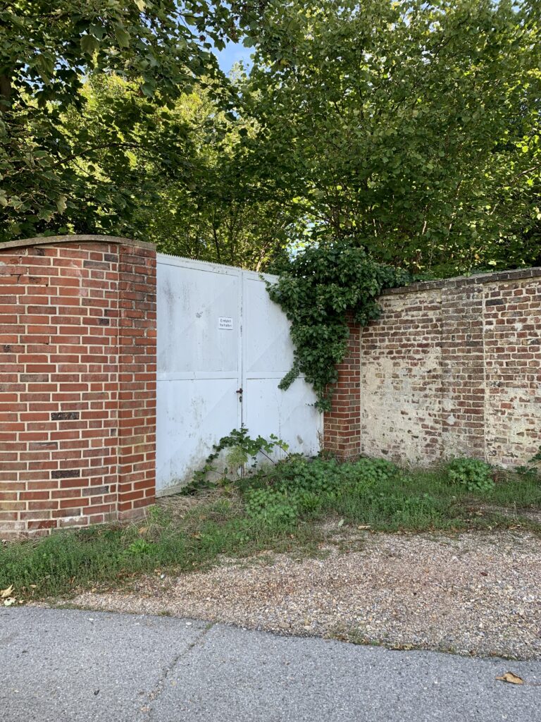
Any changes to the wall are always particularly evident where two sections of the structure meet. The first boundary point is at the ‘Villa Buth’ bus stop on Wymarstraße; the second is at the main entrance on Wymarstraße and at the entrance to the park. The third boundary point is on the west side of the site, at the gate entrance by the street Kastanienbusch. The three construction phases can be described and distinguished using the criteria set out in the description sheets.
The construction phases and their characteristics
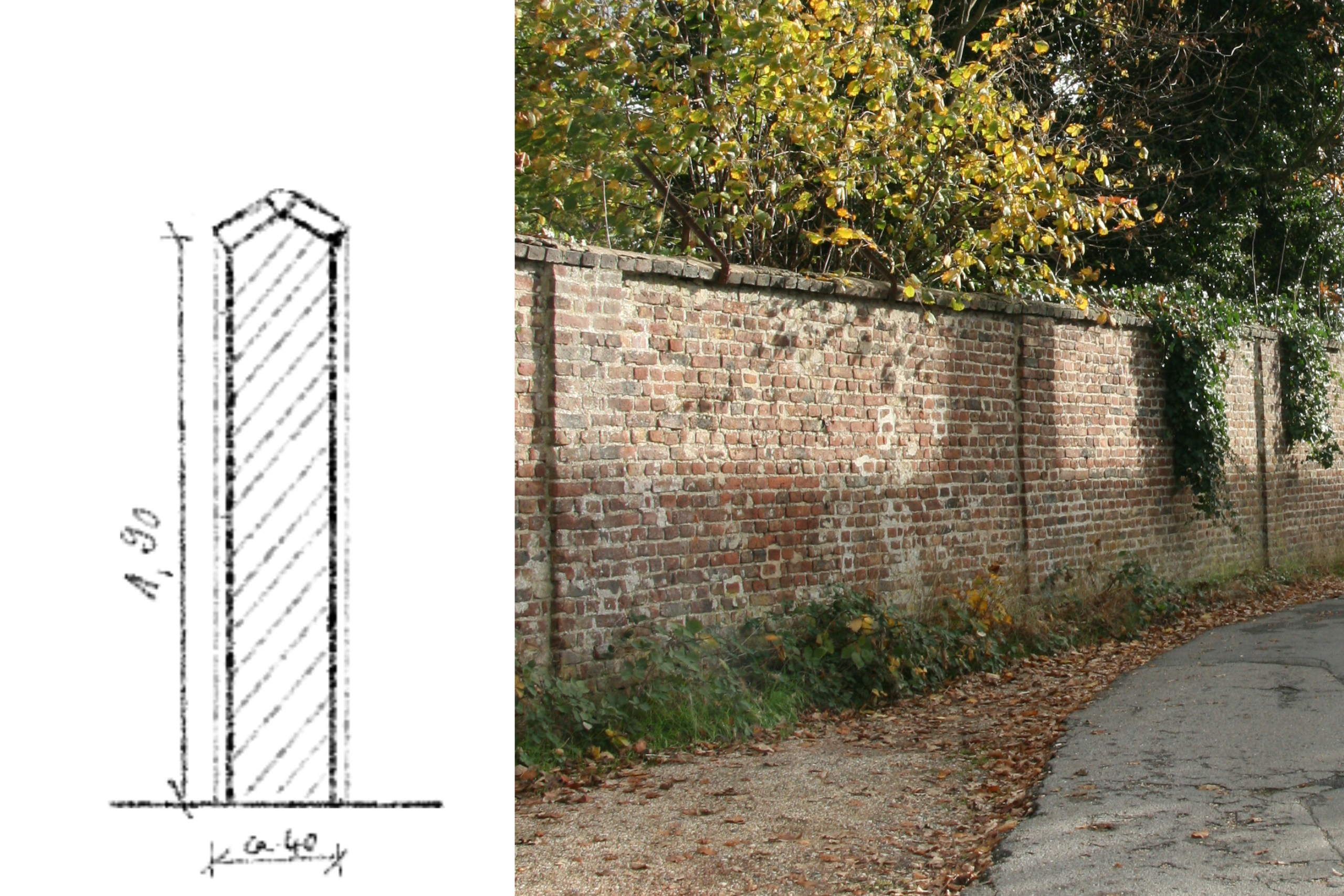
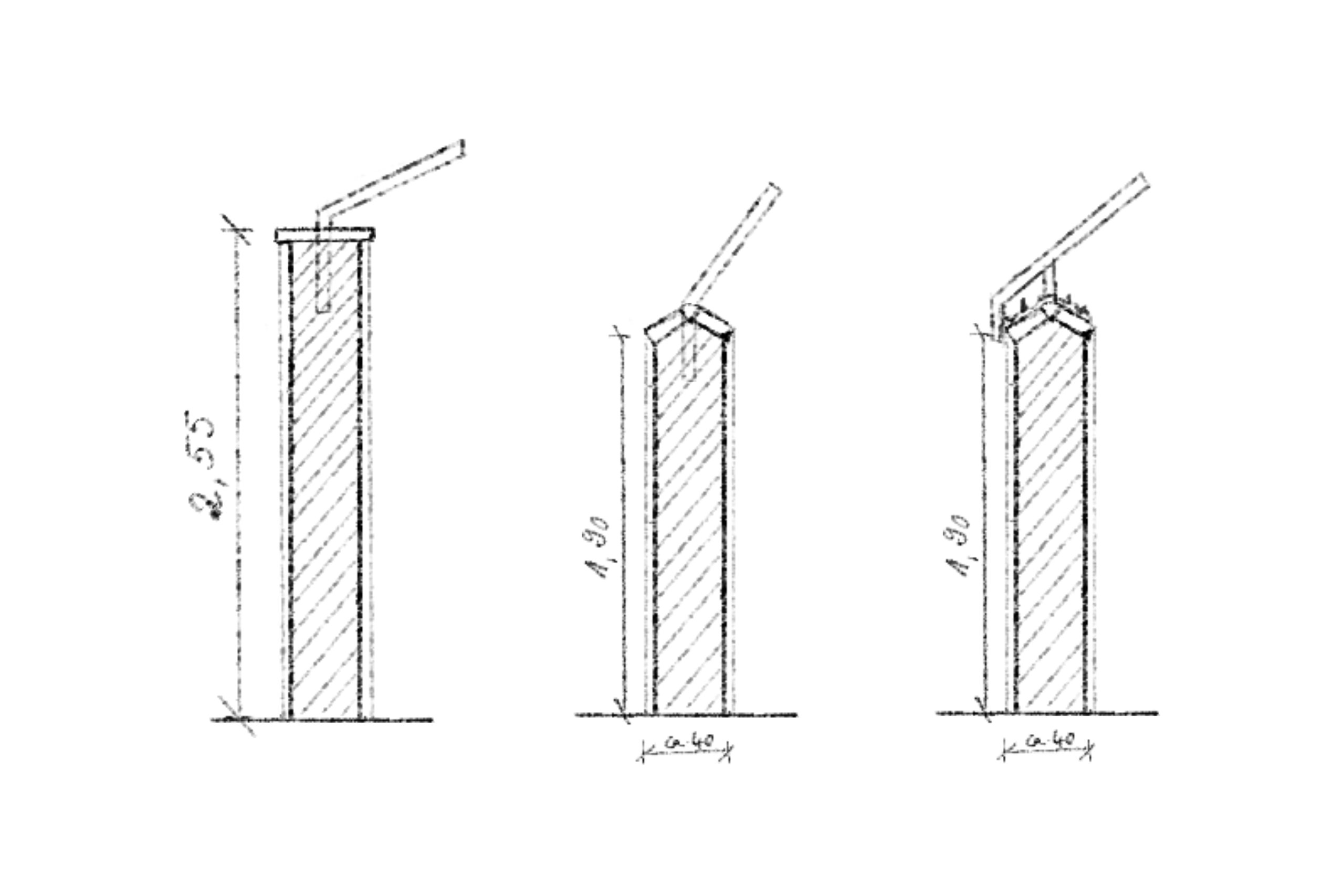
Construction phase 1: The old wall (origin)
Colour of bricks: dark, brownish-red
Height: approx. 1.95 m
Masonry bond: alternating, including cross bond and stretcher bond, amongst others
Wall coping: gently sloping bricks with a triangular cross-section
Pillars: 52 cm wide, brick-built pillars at regular intervals
Distinguishing feature: heavy efflorescence and weathering
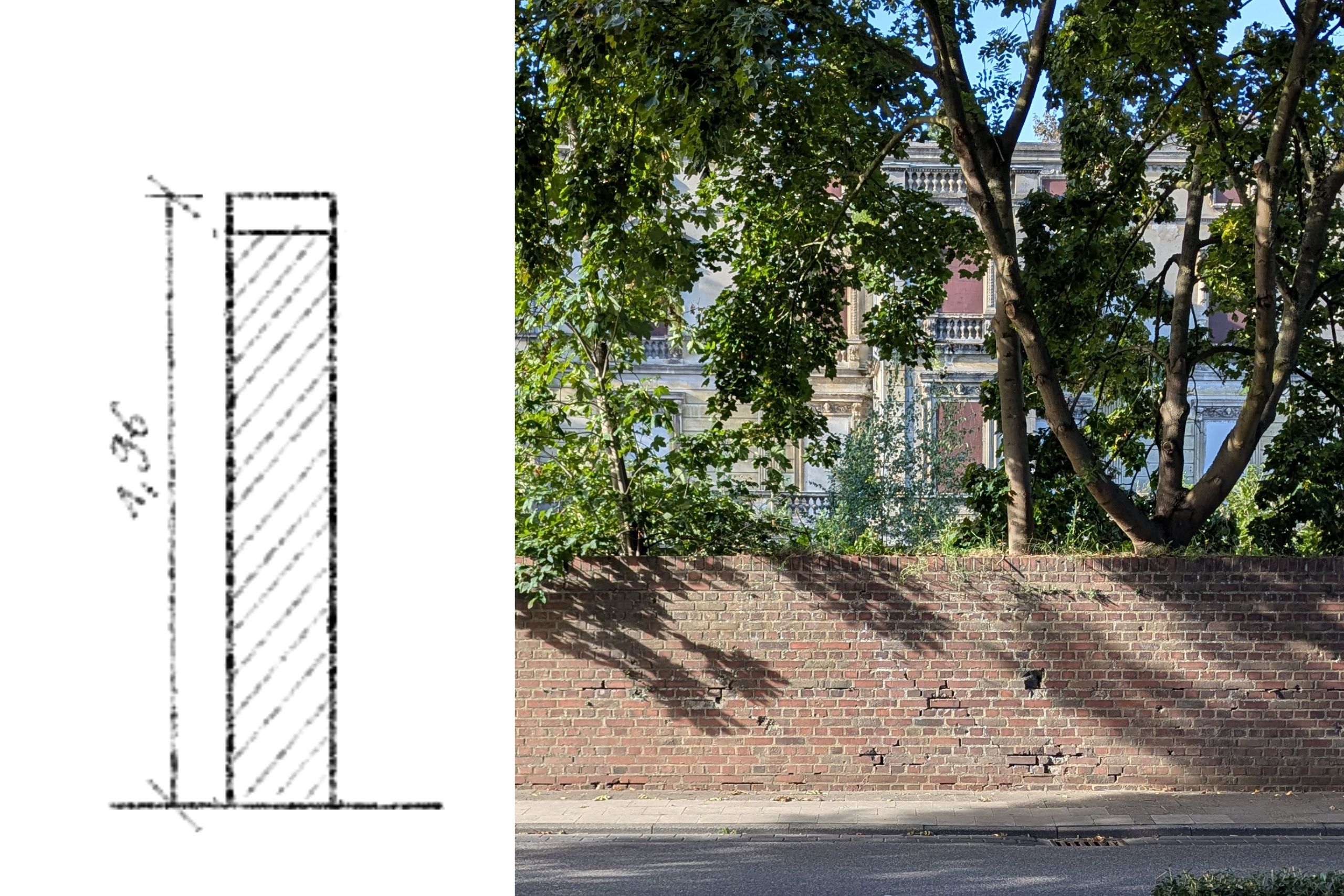
Construction phase 2: The gap-filler
Colour of bricks: warm, brownish-burgundy
Height: approx. 1.95 m
Masonry bond: cross bond
Wall coping: rolling bond
Pillars: none
Distinguishing feature: bullet holes
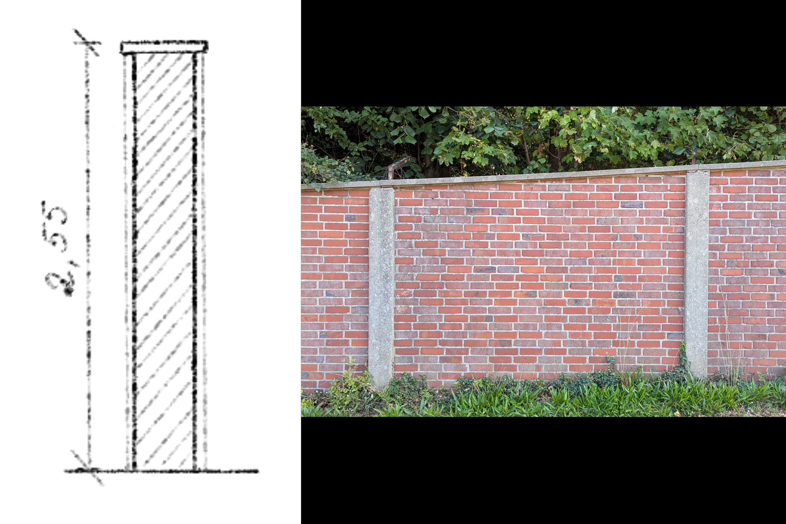
Construction phase 3: Extension
Colour of bricks: reddish-orange
Height: approx. 2.55 m
Masonry bond: stretcher bond
Wall coping: Beton
Pillars: 22 cm wide concrete pillars at regular intervals of 2.75 m
Distinguishing feature: approx. 60 cm higher than construction phases 1 and 2
The external appearance of the three sections of wall suggests that they were built in the order given. The construction period for each section can be narrowed down using historical maps, aerial photographs and oblique aerial photographs.
Damages
In sections 1 and 2 in particular, a wide range of damage can be observed, such as cracks, settlement or spalling. Much of the damage, particularly the severe efflorescence, is attributable to the effects of moisture due to inadequate structural protection. This means, for example, that a lack of maintenance has allowed water to penetrate the masonry via the top of the wall. Whether there is a risk to stability must be assessed on a case-by-case basis. To preserve the wall, particularly sections 1 and 2, it is necessary to act as soon as possible.
Narrowing down construction times
The on-site investigation raises questions. When was each section of the wall built? And for what purpose?
Although an archive search cannot yet provide conclusive answers to these questions, it can help narrow down the possible answers.
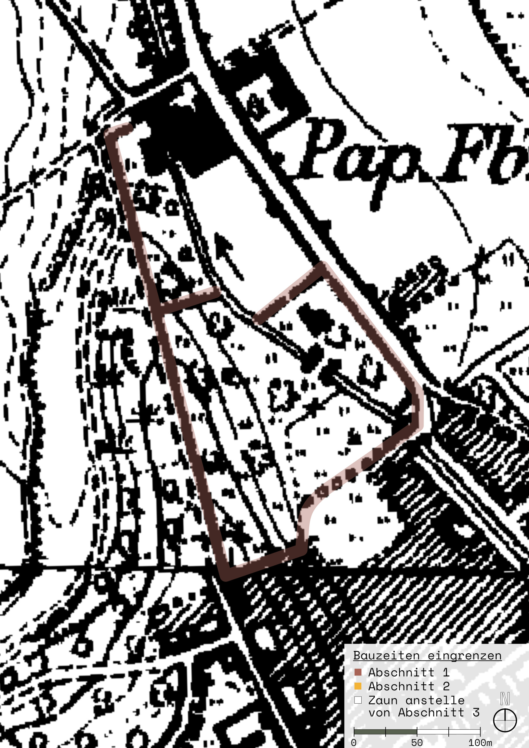
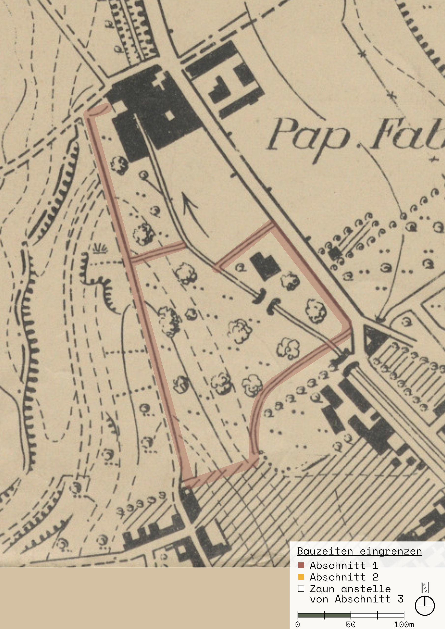
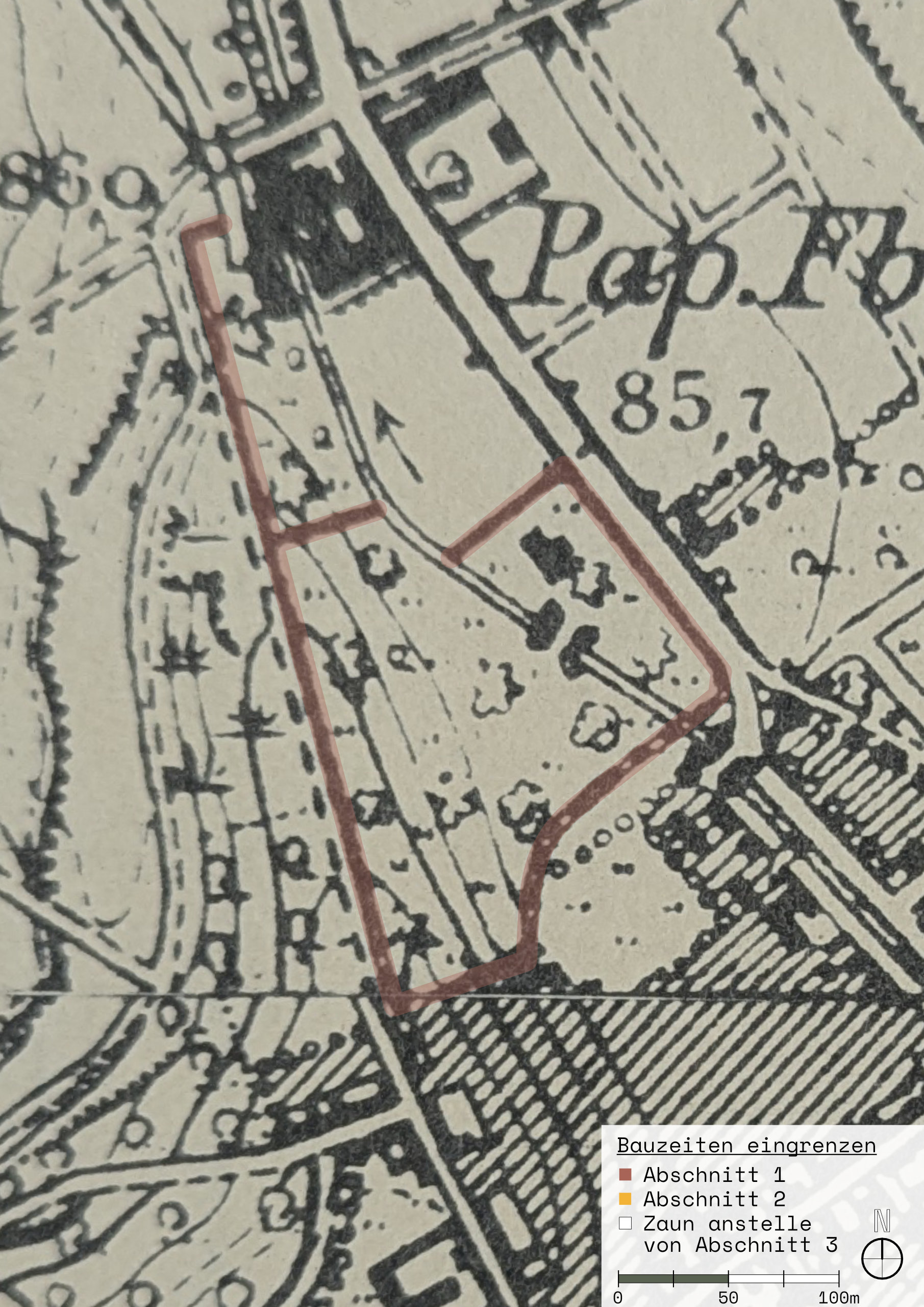
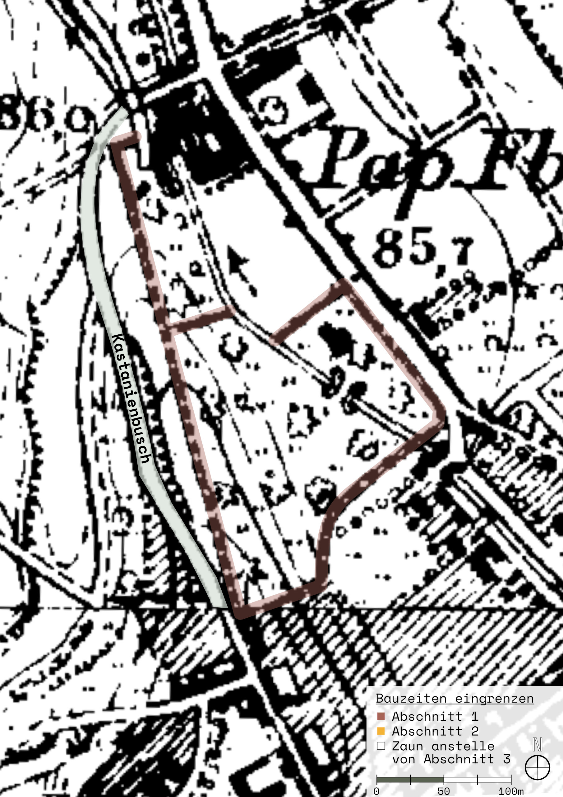
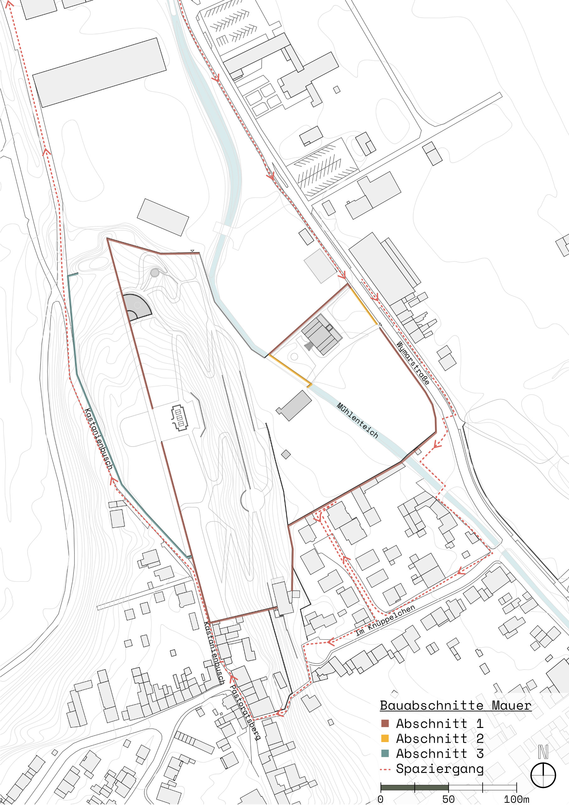
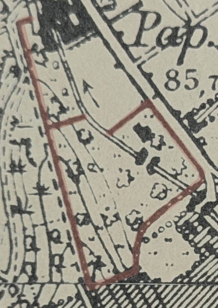
Construction phase 1 is the verifiably oldest section of the wall. It is already roughly mapped in the Prussian survey of 1891–1912 and in a slightly more detailed copy from 1926 [2, 3]. It is therefore likely that it was built at the same time as the villa or even before its construction in 1893. In the map ‘The Town of Jülich within the 1937 Boundaries’, the structure is mapped for the first time with a clearly defined wall line, and its course already corresponds relatively closely to that shown on modern maps [4]. The updated version of the Prussian survey from 1936–1945 shows only minor differences from the 1937 map. The road to the west of the plot (now Kastanienbusch) was added in the 1920s; prior to that, there was only a footpath running along this side of the plot [6].
If one compares the historical maps with the current course of the wall, one notices discrepancies. Moreover, the shape of the villa on the historical maps does not quite match its current form. The Prussian map series were produced on a scale of 1:25,000, which corresponds to a coarser level of detail and could be the reason for the inaccuracies. Whilst the maps from the Jülich City Archives are drawn to a more precise scale, they were presumably based on the Prussian map series due to the high degree of correspondence between them.
The historical maps do not reveal what Construction Phase 2 looked like at the beginning of the 20th century. Contemporary witnesses reported that, prior to the establishment of the Jewish transit camp, the section directly in front of the villa consisted of an ornamental fence on a low plinth, similar to that which is still partially visible today at Villa Eichhorn. According to these accounts, Construction Phase 2 was erected around 1940–1941. [5]
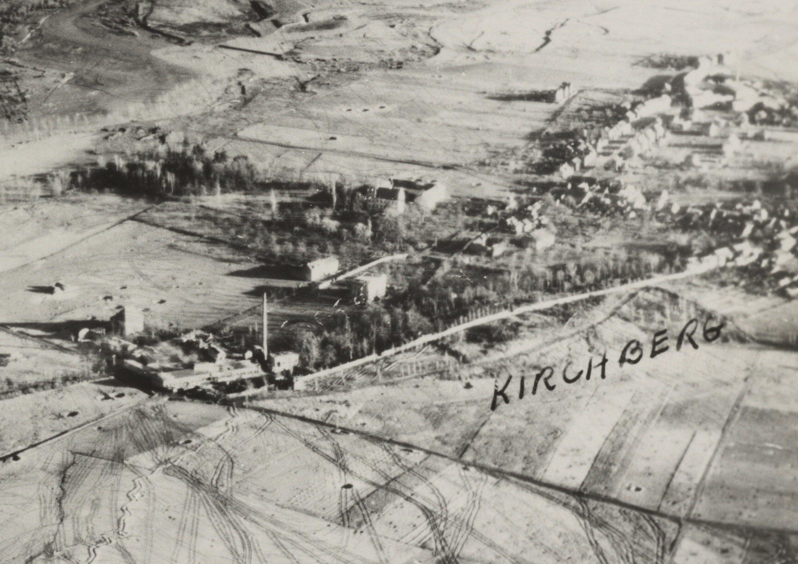
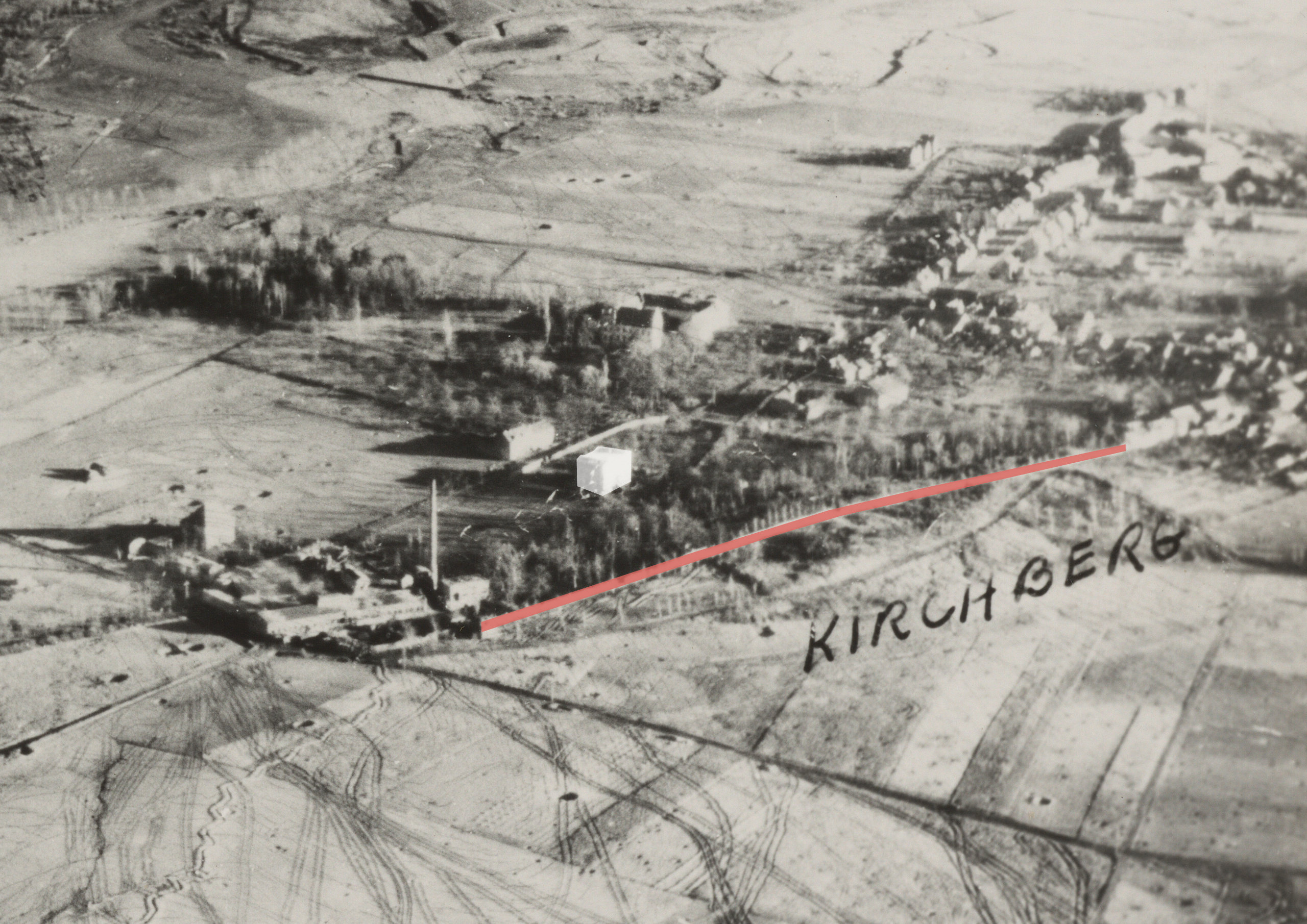
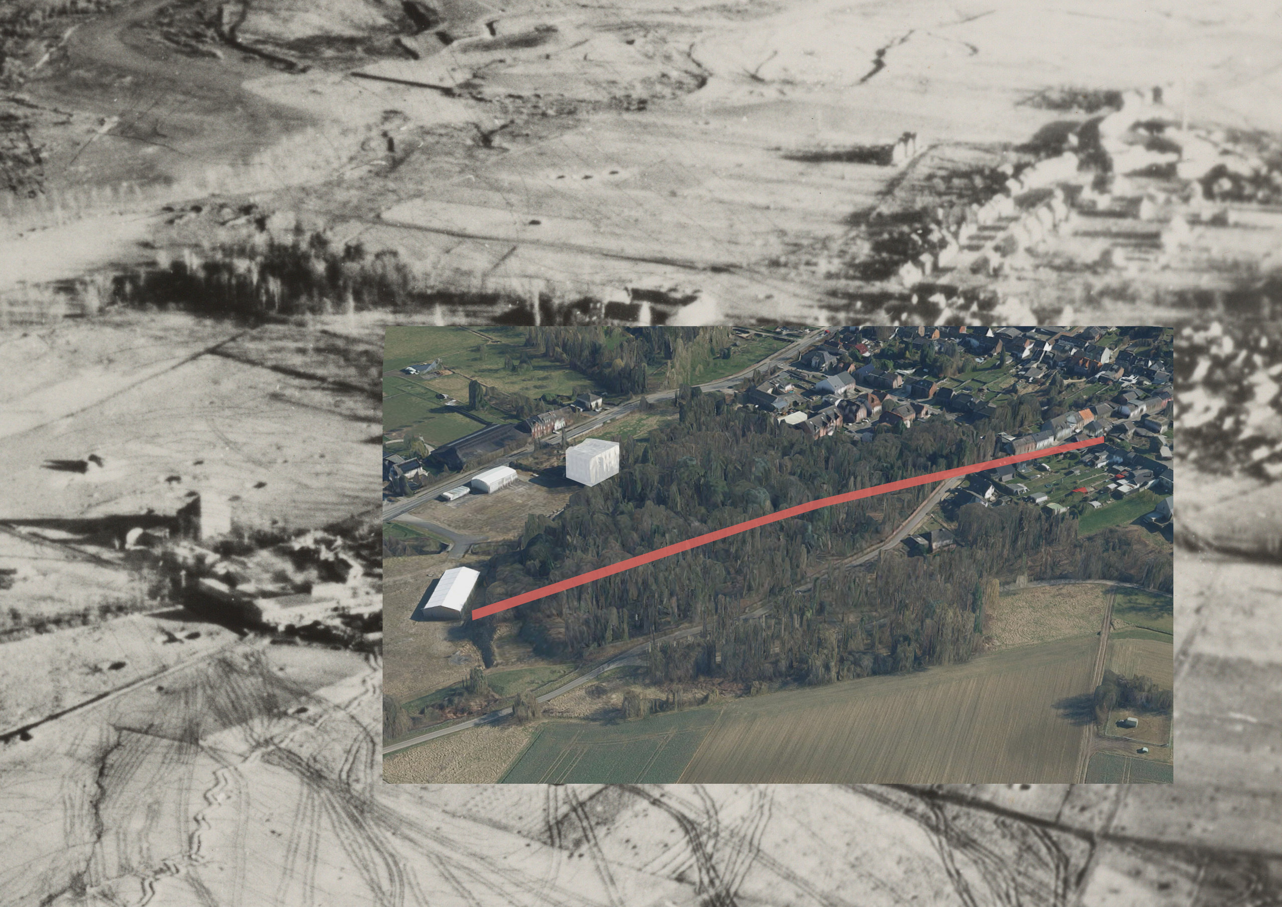
For the third and most recent phase of construction, the construction period can be narrowed down with relative precision. An oblique aerial photograph from 1944 clearly shows the site from the west. A comparison with the situation today reveals that the wall at Kastanienbusch (construction phase 3) did not yet exist in 1944. Construction phase 1, on the other hand, extended across the entire original rear section of the park. [7]
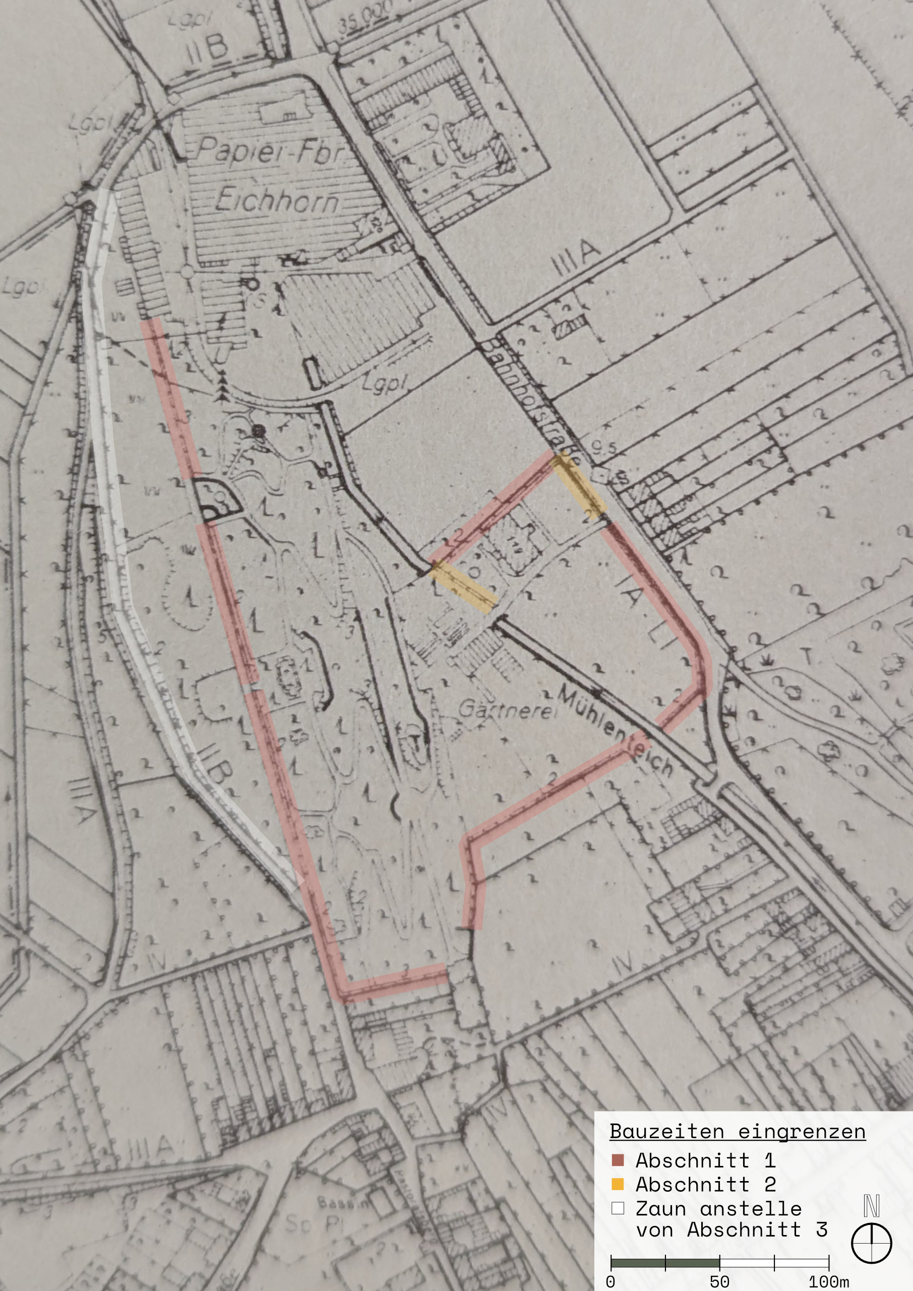
On the 1954 German Basic Map (scale 1:5000), no wall is visible at Kastanienbusch either. A fence marks the boundary between the plot and the road here. [8]
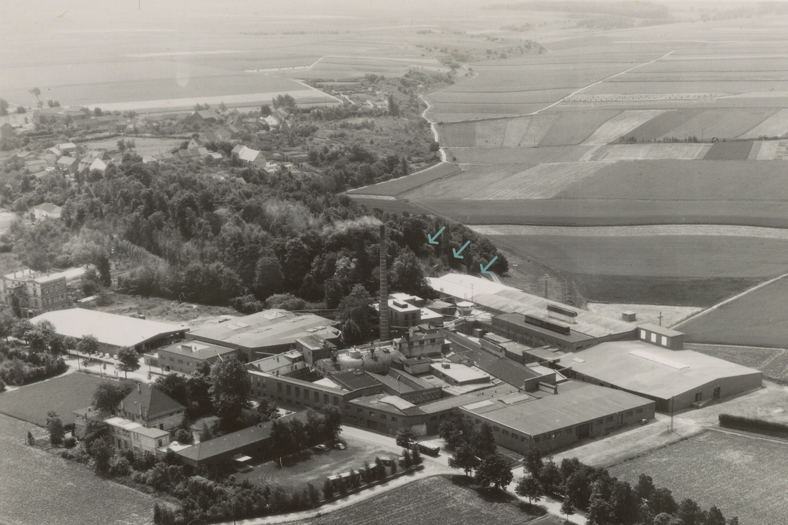
Construction phase 3 can be identified for the first time in an oblique aerial photograph from the 1960s (probably 1963). [9] It was therefore built between 1954 and 1963. errichtet.
In summary, the construction periods can be narrowed down as follows:
- Construction phase 1: late 19th century
- Construction phase 2: approx. 1941, for the establishment of the Jewish transit camp
- Construction phase 3: between 1954 and 1963
Prison architecture?
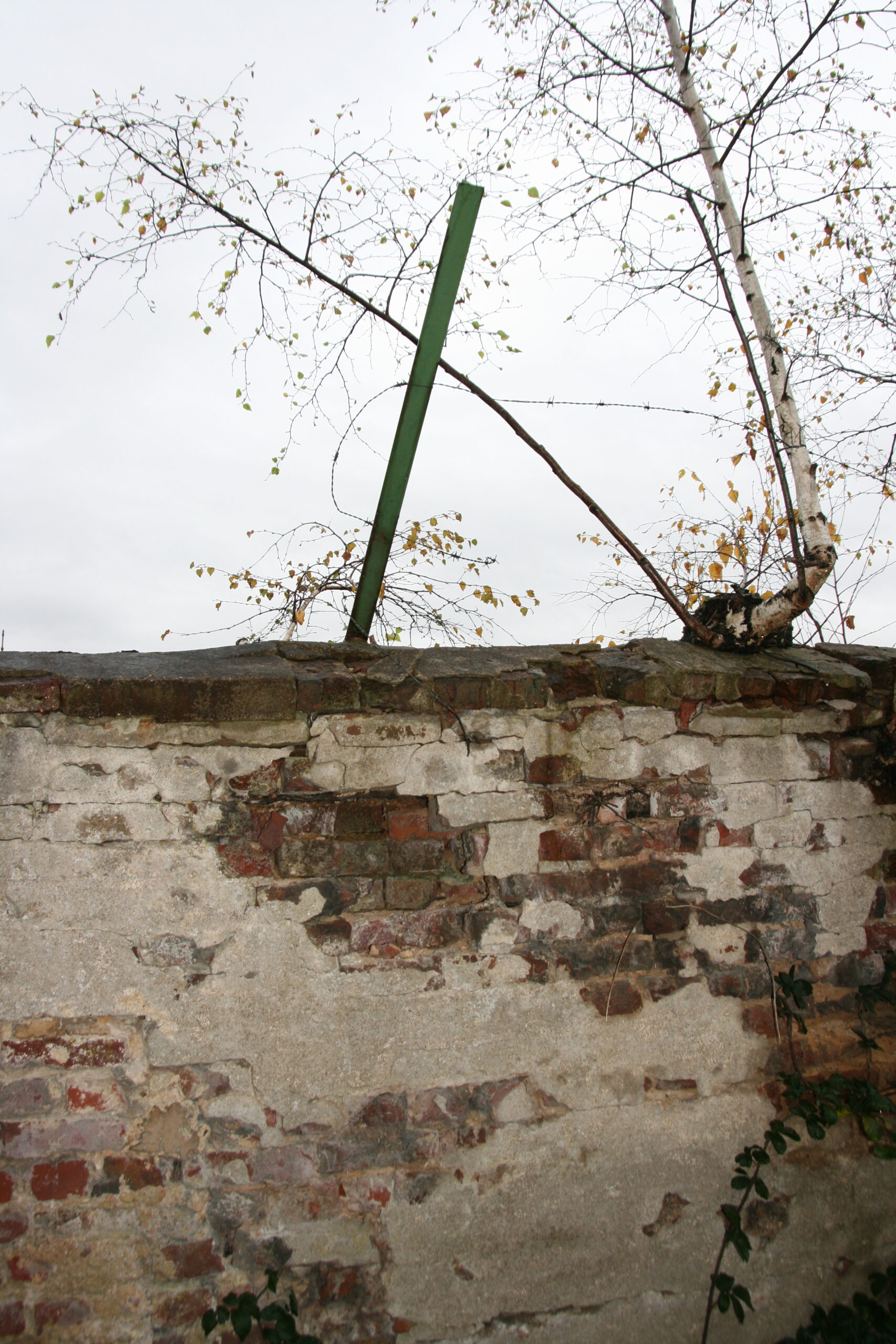
Throughout Construction Phase 3 and in parts of Construction Phase 1, inward-facing structures containing remnants of barbed wire can be found. Combined with the high perimeter wall, the complex has a fortified character. Is this a Prison architecture? A facility built for the purpose interning Jewish citizens in an internment camp?
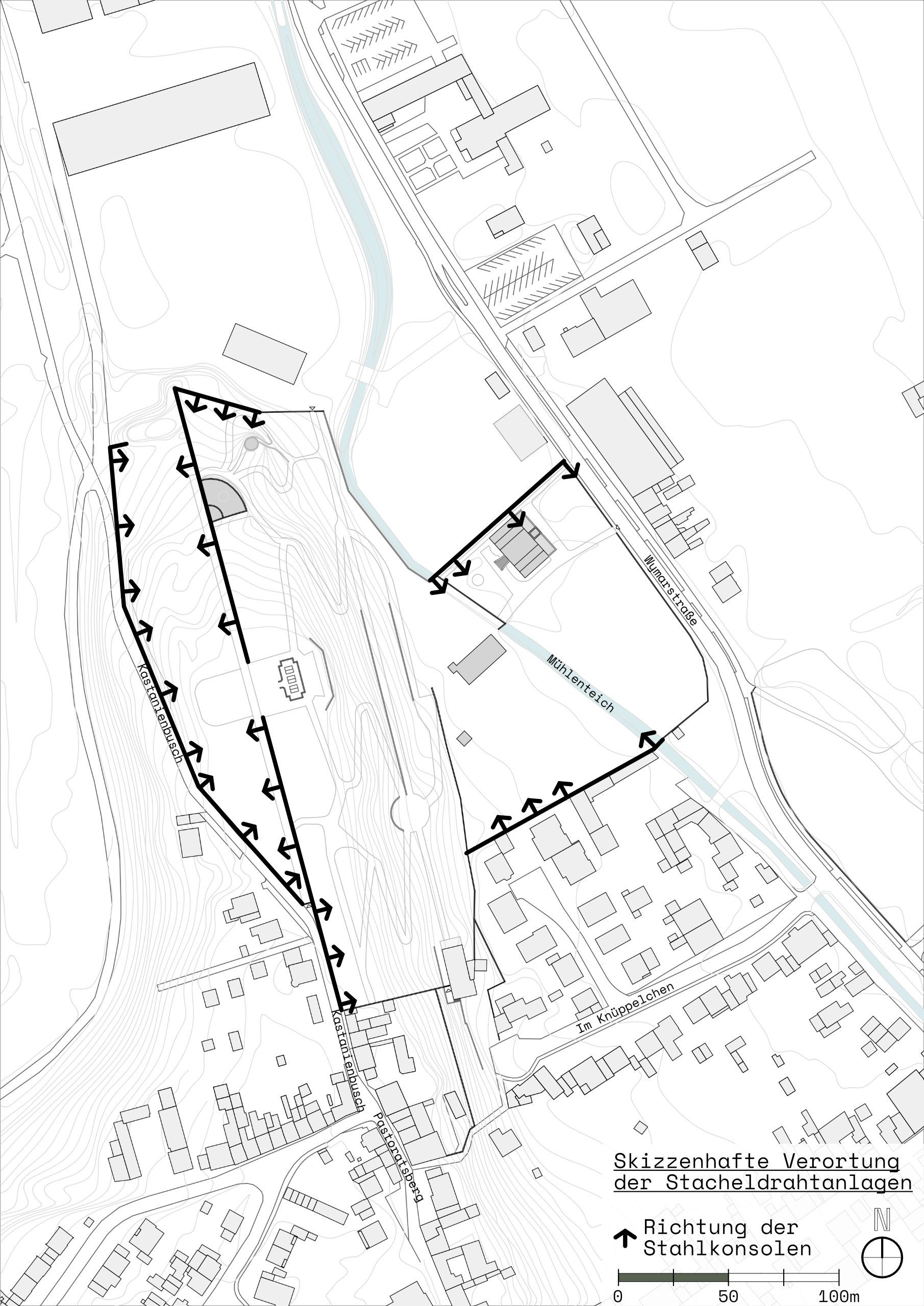
The fact that barbed-wire fences were also installed on construction section 3 contradicts this theory, as this part of the Wall was not erected until 10–20 years after the deportation of the Jewish people. Eyewitnesses also testified that they had no recollection of any barbed-wire fencing. [5]
We can only speculate here as to when and why the barbed-wire barriers were erected. It is possible that they were intended to prevent unauthorised access to the car park or factory premises.
Nevertheless, even without the barbed-wire fence, the wall – 2 metres high and in places 3 metres high – presented a significant physical barrier The addition of Construction Phase 2, in particular, makes it abundantly clear that interaction between those inside and outside the walls was intended to be strictly controlled and restricted. Even today, the physical manifestation of this demarcation is strongly felt. The enclosure clearly conveys that this site is off-limits.
Architectural research is worthwhile
Observing the wall structure demonstrates just how important the structure itself is as a primary source. The more accurately we record, measure, map and observe it, the more conclusions we can draw about the history of its construction and its significance. The Wall has a story to tell. We just have to let it speak!
[1] M. Kummer und T. Ohrndorf, „Architektur und Baugeschichte der Villa Buth,“ in Villa Buth: Zwischenstation zum Holocaust (Veröffentlichungen des Jülicher Geschichtsvereins 1923 e.V. 22), T. Ohrndorf und I. Gedig, Hg., 2. Aufl. Ammianus Verlag, 2024, S. 19–33.
[2] Preußische Kartenaufnahme (Neuaufnahme), 1891-1912. Zugriff am: 28. Dezember 2025. [Online]. Verfügbar unter: https://www.tim-online.nrw.de/tim-online2/
[3] Stadtbauamt: Andereya, Jülich. Übersichtsplan der neuen Straßen [zur Eisenbahnreparaturwerkstätte]. Stadtarchiv Jülich D-40, 1926. Zugriff am: 28. Dezember 2025. [Online]. Verfügbar unter: https://actapro240.kdvz.nrw/actaproweb/image.xhtml?id=532662be-aaaa-4e4f-ab78-f4ef6cd5a2e6
[4] Die Stadt Jülich in den Grenzen von 1937. Stadtarchiv Jülich, E-11, 1936-1944.
[5] E. Römgens und T. Ohrndorf, „Alltag und Überwachung der Juden in der Villa Buth von März 1941 bis Juli 1942,“ in Villa Buth: Zwischenstation zum Holocaust (Veröffentlichungen des Jülicher Geschichtsvereins 1923 e.V. 22), T. Ohrndorf und I. Gedig, Hg., 2. Aufl. Ammianus Verlag, 2024.
[6] Fortführung der Neuaufnahme, 1936-1945. Zugriff am: 28. Dezember 2025. [Online]. Verfügbar unter: https://www.tim-online.nrw.de/tim-online2/
[7] F. Stadtarchiv Jülich, Luftaufnahme von Kirchberg, Luftaufnahme von Kirchberg, November 1944, angefertigt von einem Aufklärungsflugzeug.
[8] Stadt Jülich, Stetternich, Kirchberg, Altenburg, Selgersdorf, Daubenrath: angefertigt aus 17 Blattausschnitten der Deutschen Grundkarte, Grundriß 1:5000. Stadtarchiv Jülich, D-46, 1954.
[9] Hamburger Aero Lloyd,Luftaufnahme um 1960, Stadtarchiv Jülich, Fotosammlung 03-7